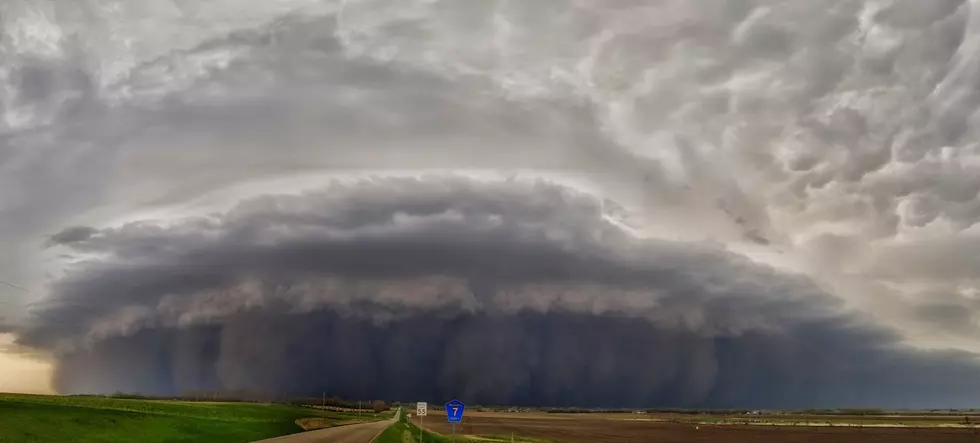
Incredible Photos Of Thursday’s Storms In Brookings, As They Approached Minnesota
Pictures are worth a thousand words. A popular saying that only rings more true when you see these photos taken by a Minnesota man while he was in South Dakota Thursday. These are the same line of storms that walloped portions of the Twin Cities and Central Minnesota, causing downed trees, power outages, and localized flooding.
An incredible and destructive line of storms passed through western South Dakota and western Minnesota yesterday. I took these shots just north of Brookings, SD, after abandoning my chase for tornadoes along a stalled-out warm front. As the line tracked closer to me, I could make out, not only a shelf cloud but a massive cloud of dust/dirt being pushed out ahead of the line (much like a sand storm). Gusts of 70-90 mph were common in this line, as it tracked north-northeast across northeast Nebraska, northwest Iowa, eastern South Dakota, and western Minnesota. A max gust of 107 mph was even measured in eastern South Dakota. Just incredible! Unfortunately, this line did end up overtaking me, as it accelerated through east-central SD, cutting off my escape route.
The photographer of these AMAZING photos is Allan Persons, a Meteorologist, and Storm Chaser, who resides in Lakeville. He was near Brookings at the time he took these photos of the storms rolling in. Just look at that wall of dust that is accompanying the storms!
On top of these incredible photos that were captured by Allan, there are other photos that have been shared online that tell the story of just how powerful these storms were.
This shelf cloud photo was from Thursday night in Dakota County, taken near Greenvale Township, located to the North of Northfield.
Finally, this lightning bolt was captured by a dashcam in Lakeville, what a great picture!
The Ultimate 2022 Summer-Fun Guide For Southeast Minnesota
This Luxurious Minnesota Airbnb Places You On The Shore Of Lake Superior
More From Sasquatch 107.7 - The Rock of Rochester


