

Southeast Minnesota Winter Storm to Bring Ice, Wintry Mix, and Travel Impacts
In classic early April fashion, Southeast Minnesota is about to get another dose of winter, and while it may begin as a simple rain event, it won’t stay that way for long.
READ MORE: The Story Behind Those Fighter Jets Towering Over I-35 in Owatonna
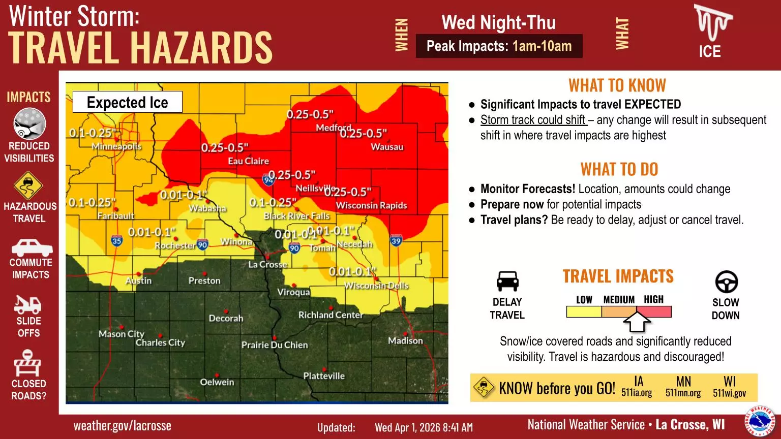
The National Weather Service in La Crosse is warning that a developing winter storm will bring a messy mix of precipitation overnight Wednesday, along with hazardous travel conditions through Thursday morning.
Timeline: Rain Transitions to Wintry Mix Overnight in Southeast Minnesota, Western Wisconsin
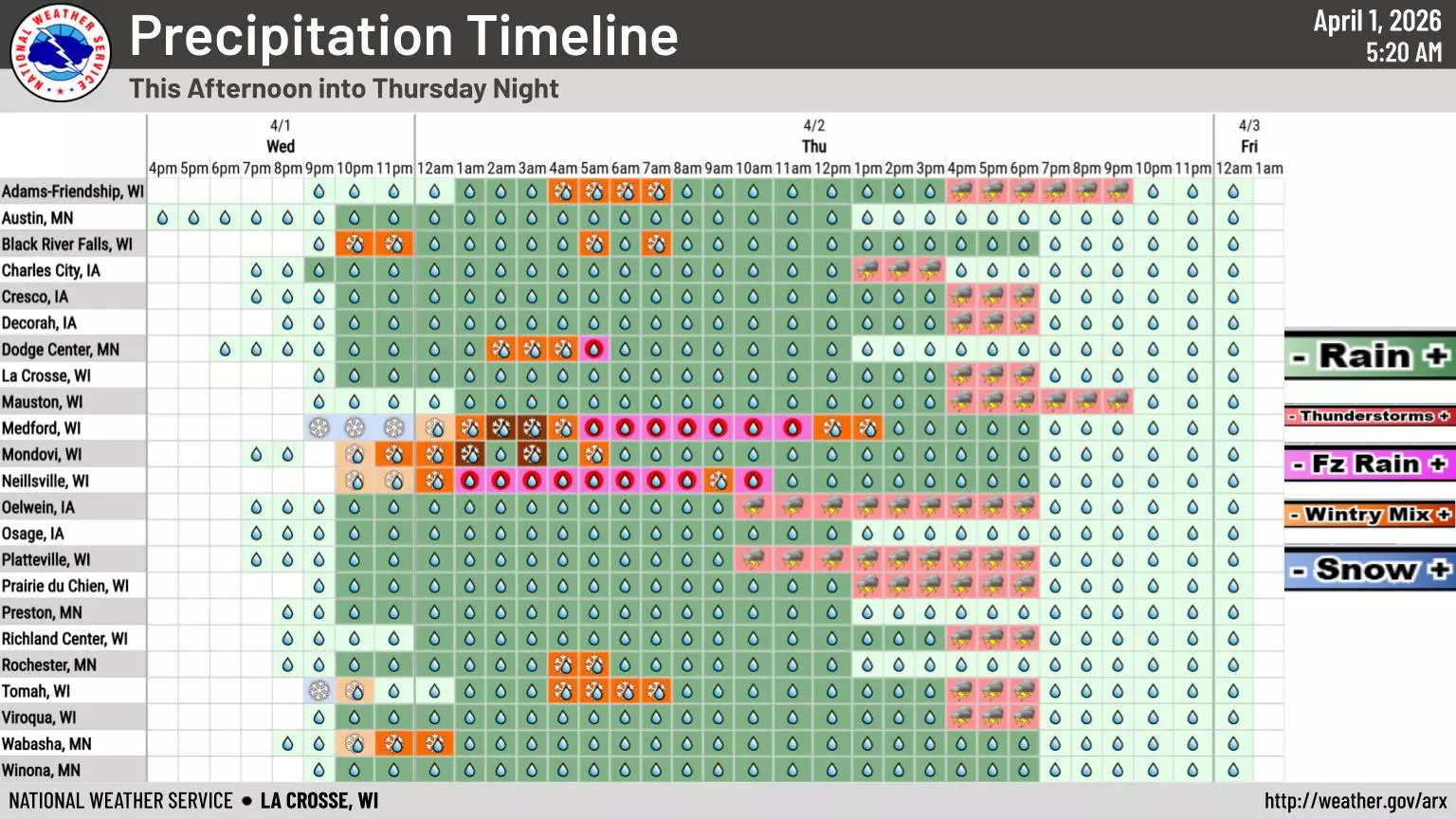
The storm will arrive in stages, and that transition period is where conditions could deteriorate quickly.
According to the National Weather Service, precipitation will begin as rain across parts of Southeast Minnesota and Western Wisconsin Wednesday evening before shifting to a wintry mix of freezing rain, sleet, and snow overnight between I-90 and I-94.

That includes Rochester and the surrounding region.
The most impactful window is expected between roughly 1 a.m. and 10 a.m. Thursday, when temperatures hover near freezing and create the potential for icy surfaces.
By late Thursday morning, conditions improve as temperatures rise.
“All locations changeover to rain by late Thursday morning,” the National Weather Service says.
Ice and Travel Hazards Expected, Especially Early Thursday
While the heaviest icing is expected just east of Minnesota in parts of Wisconsin, Southeast Minnesota is still likely to experience enough freezing rain and mixed precipitation to create dangerous travel conditions.
The National Weather Service warns that the combination of freezing rain and fluctuating temperatures will lead to slick roads, reduced visibility, and difficult driving conditions during the Thursday morning commute.
Small shifts in the storm track could change where the worst conditions develop.
Motorists should be especially cautious on bridges, overpasses, and untreated roads, which tend to ice over first.
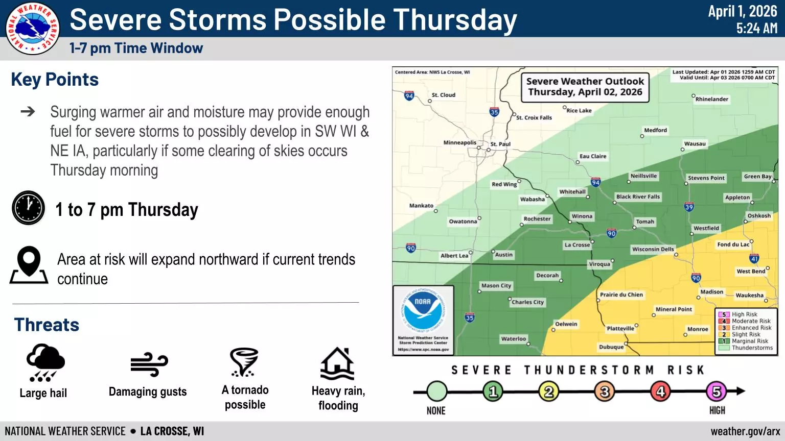
Thunderstorm Chances Return Thursday Afternoon South of I-90
Once the system moves through Thursday morning, the region won’t necessarily be done with active weather.
“Locations south of I-90 will see thunderstorm chances Thursday afternoon,” the National Weather Service said.
That means parts of Southeast Minnesota could go from icy roads in the morning to thunder in the afternoon.
11 of the Most Devastating Weather Disasters in Minnesota Throughout The Years
Gallery Credit: Jessica Williams